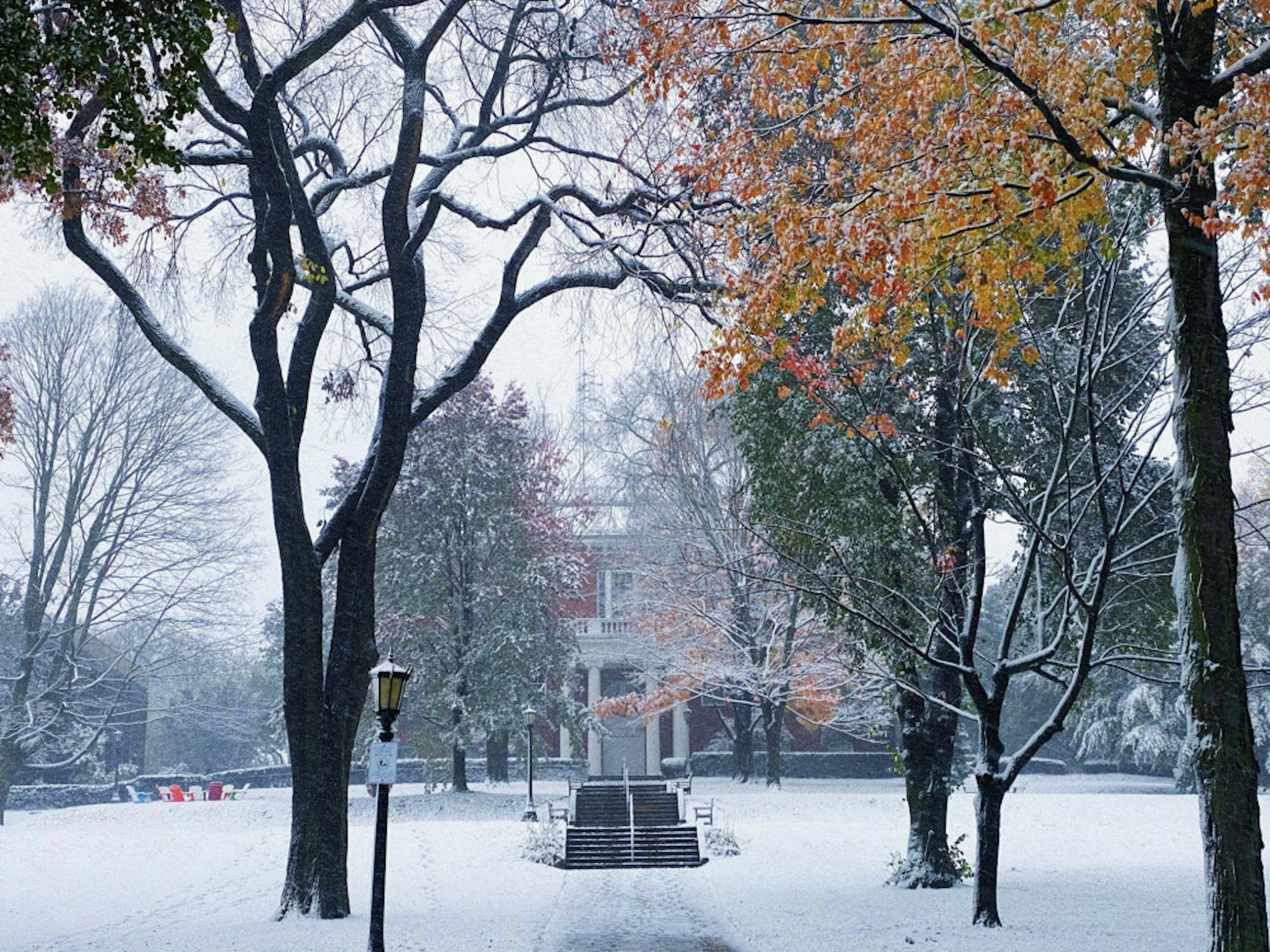
The first snow of the fall semester came the day before Halloween. Spirits were high. Tufts students rejoiced in celebrating the snow’s descent, embracing the joy of their inner child. Jumbos snowboarded, inner-tubed and sledded down President’s Lawn’s winter wonderland of a hill.
Audrey Jaramillo, a first-year, spoke of her time experiencing her first New England snow after living in sunny Miami, Fla., her entire life.
“This snow was falling and I felt the coldness in my bones … It was pretty though. It was fun to crunch the snow and step in it. The festivities looked fun. I saw people sledding and doing snow angels so I feel like that’s fun,” Jaramillo said.
Jaramillo reminisced about the contrast between Medford and Miami winters, noting that at her home in Florida there is not much difference between the seasons.
“It’s summer in winter. It’s summer all year round. So I’m still in shorts, a tank top and flip flops. It’s very different coming here,” Jaramillo said.
Jaramillo said she applied to colleges in the Northeast desiring a change of scenery. However, after experiencing a taste of the cold, Jaramillo said she doesn’t want to live in the north for long.
“I’d rather be warm than cold. Also, I don’t like to be bundled up. I like to wear dresses. I’m young, I should be showing off my body. How are you going to see me in my winter coat? You’re not! It’s not flattering,” Jaramillo said.
Local meteorologists who are more accustomed to Boston winters weighed in on what they thought of the pre-Halloween snow. Kevin Lemanowicz, chief meteorologist at WFXT Boston 25 in Dedham, Mass., explained that having snow in October is not usual for the Boston area, but an early snowfall doesn’t normally accumulate as much as it did this October.
“Boston had a record snowfall, 4.5 inches of snow ... That kind of snow we haven’t seen just before Halloween since 2011,” Lemanowicz said.
Lemanowicz said that, in a normal winter, Boston acquires its first inch of snow in November, with the coldest stretch occurring in either late January or early February, which is usually when the most snow falls. Boston acquires an average of 43 to 45 inches of snow by the end of the season.
Lemanowicz said this year is following the La Niña weather pattern, similar to fall 2011.
“When it’s La Niña, it just means that the water in the equatorial Pacific is colder than average, and that will change the pattern of the weather,” Lemanowicz said. “The atmosphere is connected everywhere, and if you make a blip in it somewhere, it’s going to reverberate around the globe, sort of like throwing a rock in a puddle.”
During the 2011 La Niña year, there was a large snowstorm just before Halloween that was followed by a mild November. That winter, Boston saw only nine inches of snow for the entire season, and every month witnessed temperatures about five degrees above average. Lemanowicz thinks the 2011 winter could be a taste of what is to come for this winter.
“If you remember, in November [of this year], we had temperatures in the 70s, in fact a record stretch of 70-degree days in November … I wouldn’t be shocked if we saw well below average snowfall and above average temperature once again, unless something were to change, ” Lemanowicz said.
Lemanowicz does acknowledge, however, that such predictions are never completely reliable, especially for meteorologists like himself who focus on short-term forecasting, not whole-season forecasting.
“As a meteorologist, I’m looking at the weather day to day. We can go out to seven days. We can probably do a good job out to 10 days or so, but when you’re talking about forecasts for an entire season, that falls more into the realm of climatology and how things are looking long term and seasonal forecasting,” Lemanowicz said.
Harvey Leonard, chief meteorologist at WCVB-TV in Boston who has been forecasting Boston weather for over 43 years, also weighed in on what he thinks this winter might bring. When asked about comparing this year’s winter to the 2011’s La Niña winter, Leonard expressed the risk of drawing too much out of an analog from one singular weather event.
“If you’re only looking at the La Niña part of it, which we’re in, it would give a little bit of a nod toward a slightly warmer than average winter and perhaps a slightly less snowy than average winter,” Leonard said. “But again, that’s only one factor, and there are other complicating factors that could come into play up in Canada and the higher latitudes.”
Leonard said climate change was among these factors that complicate the process of long-term forecasting.
“There’s no question that climate change is getting into all of this to some degree,” Leonard said.
For example, Leonard used the recent seven-day warm spell in November to explain the role climate change may be having on weather events.
“It’s very dangerous and probably wrong to completely attribute something like that to climate change because we’ve had warm spells like that in the past,” Leonard said. “But the sense is … going forward, storms like that or warm spells like that will probably occur with more frequency than they have in the past, and that’s what climate change is about.”
Leonard also speculated more generally about what future winters could look like as a result of climate change.
“We’re likely to have more above-average temperature winters than below-average temperature winters, but it does not mean every single winter will be warm,” Leonard said.
Justin Hudson, a 2019 Tufts graduate who is currently pursuing a master's in atmospheric science at Colorado State University, studied environmental geology and astrophysics at Tufts and conducted his senior thesis on Boston snowfall trends. He found the number of days on which it snows is decreasing, yet the frequency of very large snowfall events has increased significantly in recent years.
Hudson presented a graph in his senior thesis: “Cumulative Yearly Snowfall Since 1893/94 for Boston, MA.” The top five winters with the most snow all occurred in the past 25–30 years, despite the data record’s going all the way back to 1893.
“All these events are happening in 20 years. It’s a little too concentrated. We’d expect one in the 1910s, one in the 1930s and so on, but not all concentrated in recent time,” Hudson said.
After looking at Boston snowfall trends, Hudson expanded his data collection from weather stations along most of the East Coast, as far south as Virginia. Hudson found that one-third of all cities providing enough data to conduct statistical analyses showed extreme increases in large snowstorms in the past 20–30 years.
Hudson looked at storms accounting for 20%, 30% or 40% of annual snowfall, and “once in a century storms” that generated 40 or more inches of snowfall.
“In some of these spots, we see these storms happening every 10 years instead of every 100 years,” Hudson said.
Hudson found an increase in both snowfall and how often the extremely large category snowfall events occurred in Boston, New York and Philadelphia. In the past 20 years, those cities saw 7–10 more inches of snowfall on average per year.
“I found that on average, there are less storms happening that produce any amount of measurable snow, but each storm is on average putting more snow onto the Boston area,” Hudson said.
When asked if the increase of large snowstorm events results from climate change, Hudson, like Leonard, expressed how it is difficult to prove that climate change drives individual occurrences.
“It started sometime in the ‘90s. It’s a very recent increase. It highly suggests it could be due to climate change, but I can’t make that guarantee with the results I had,” Hudson said.
Hudson outlined how atmospheric temperature alteration from climate change may affect snowflake geometry as a result of snowflake crystals’ extreme sensitivity to their surrounding conditions.
“Due to some slight change in aerosols overhead, or temperature in the clouds, you get a different shape of snowflake, and that shape happens to pack in a way that can make the height of your snow pile double,” Hudson said.
According to Hudson, the warming of air from increasing carbon dioxide levels could be changing the height at which storms occur in the atmosphere, which could be altering the snowflake’s geometry and how it packs when hitting the ground.
Hudson also shared that climate change researchers predict that as the globe warms, existing weather patterns may stay the same but become enhanced.
“Places that are wet get wetter, places that are dry get drier, places that are hot get hotter,” Hudson said.
Hudson acknowledged that another theory hypothesizes climate change will completely alter how weather interacts in regions.
“A place that is a desert could be much wetter, such as a grassland … There is not a set-in-stone answer,” Hudson said.
At the end of the day, with the complicated role of climate change and wide variety of possible weather events that could occur in Boston, it seems that Tufts students will not have a good sense of what the upcoming winter will be like until they are in the thick of it themselves. Leonard may have put it best.
“Anything abnormal is normal,” Leonard said.